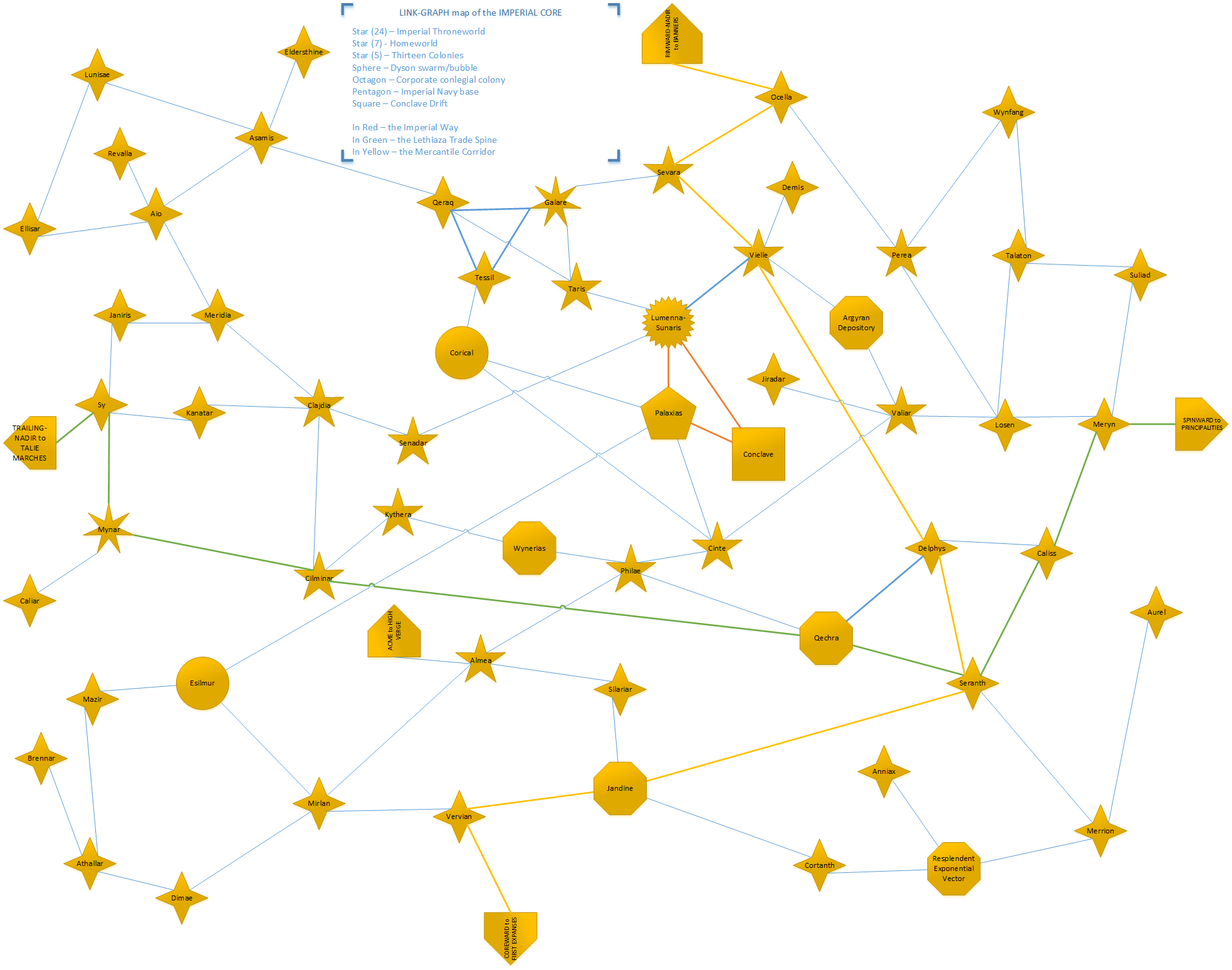
For those following along with these stories at home (or on holiday, or during your commute, or at work – why not?), I just found some time to clean up one of my rough sketch-maps of what the universe looks like, so thought I’d share it with you. This is a relatively small part of the whole Associated Worlds (just one of the many linked constellations, which as you may recall in galactographic parlance means “cluster of stars linked with short-range wormholes, linked to other constellations by long-range wormholes), but it is one of the oldest and most important regions: namely, the Imperial Core itself, the 57 stars right at the heart of the web that includes the Empire’s throneworld, the Conclave Drift, and other such significant worlds, trade routes, etc., many of which have been mentioned in one context or another:
(It’s quite a big image; click to enlarge.) You’ll also notice that it’s what they call a “link-graph map”, meaning that it’s like a metro map – the links between stars are correct, but their actual relative physical positions are, ah, not necessarily so. The more so because this is, of course, a 2D projection of 3D space. This is exactly what you want for most interstellar travel, which is done purely by ‘gate – those who are flying around in relativistic clippers, on the other hand, will need to go buy a real-space starmap instead. (Available from your local Grand Survey franchise!)
Enjoy!

